The natural landscapes of the Greater Springfield area
The natural landscapes of the Greater Springfield area
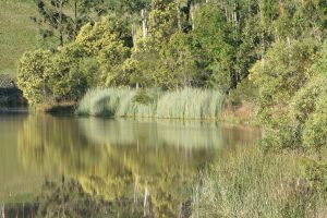
Waterways
All landscapes are divided into catchments areas, which in simple terms is a region where all rain falling on that region will eventually feed a single creek or river. Landscapes have highlands made up of hills, mountains or high plateau, where the water that falls on one side will go in one direction, and the water falling on the other side will travel a different route down different creeks and rivers; these ridge lines are called “catchment boundaries”. In the highlands, or headwater areas, the water that runs down the slopes after significant rain ends up in 1st order ephemeral drainage lines. These small gullies are usually dry and only have water in them after significant rainfall. When they flow, the water flows downstream where the waterway usually meets another waterway of similar size and character, forming a 2nd order waterway. Whenever two waterways of the same order meet, the order of the joined waterway increases by one, otherwise the stream-order keeps the value of the larger of the two joining waterways. Eventually the waterway, or now usually called a creek, becomes so large that when significant rain falls the creek channel cannot contain all the water flowing into it and the water spills out across the surrounding land in a flood. The pace of this flood water slows and drops the sediment that it is carrying, and this forms the flat floodplains that are prized for growing crops and vegetables due to their deep fertile soils.

Springfield Lakes, despite being part of Ipswich, sits within the Lower Brisbane River catchment. All rain that falls within the greater Springfield region either finds its way back into the sky through evapotranspiration before it reaches a waterway, or once into a waterway, eventually finds its way into the Brisbane River and out into Moreton Bay.
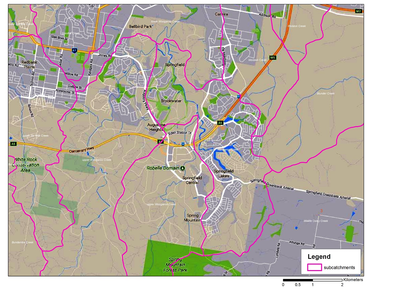
The highland areas that occur here are Spring Mountain and White Rock, with a much lower catchment boundary along the edge of the Greenbank Military reserve. The major creeks are Mountain Creek, Opossum Creek and Woogaroo Creek. (see further information on map “Springfield Lakes subcatchments”)
Mountain Creek is sourced on the north western side of Spring Mountain, and flows north through Robelle Domain and along the northern entrance to Orion Shopping Centre and the Springfield Central Train Station and joins Opossum Creek at the bottom of the hill heading north into Springfield. (see further information on map “Springfield Lakes subcatchments2”)
Opossum Creek is also sourced on Spring Mountain, but on the north eastern side. It flows to the north just to the west of Grand Avenue, crosses under the Greenbank Arterial Road and into the top of Discovery Lake, the most southerly of the three lakes that make up Springfield Lakes. The lake was formed through the damming of the natural watercourse of Opossum Creek. The creek then winds its way between Creekside (south) and the Aspect (north), then north behind The Springfield Anglican College and under the Springfield-Greenbank Arterial again to join Mountain Creek. Opossum Creek then takes the water from Mountain Creek (which now ends) and continues to flow to the northwest along the northern boundary of Brookwater until it joins Woogaroo Creek at Bellbird Park.
Woogaroo Creek is sourced on the western slopes of Spring Mountain and flow north through Augustine Heights, under the Augusta Parkway and separates Brookwater from Bellbird Park until it meets Opossum Creek. Woogaroo Creek then takes the water from Opossum Creek (which now ends) and continues to flow to the north and into the Brisbane River at Goodna.
Some parts of northern part of Greater Springfield are part of the Sandy Creek catchment. This flows north from its source at the very northern tip of Springfield Lakes near the Centenary Highway, then flows northeast, then northwest under the highway and through the old section of Greenbank Military Reserve to the west of the highway> It then flows through Camira, Carole Park and Wacol, where it joins Bullock Head Creek to form Wolston Creek, which flows west along the urban fringe of Jamboree Heights south of Sumners Road, to where it directly into the Brisbane River at Riverhills.
Some of the very eastern parts of Springfield Lakes slope down towards the east into the Greenbank Military Reserve and water here flows to either Blunder Creek or other tributaries of Oxley Creek, which makes its way to the Brisbane River at Oxley.
Greater Springfield suburb map
http://www.greaterspringfield.com.au/wp-content/uploads/2016/05/SLC_Suburb-Map_2.pdf
Development master plan
http://www.greaterspringfield.com.au/wp-content/uploads/2015/03/greater_springfield_masterplan.pdf